The biography of the Pripyat town
 The name of the Pripyat city, as we know, is derived from the name of the river on whose shores has been constructed the first Ukrainian atomic-town. The biography of the Pripyat city begins on February 4, 1970, when builders hammered the first peg and dug the first bucket of earth for the construction of building foundations. The choice of location for the city was optimal, due to the existence of a nearby railway station, a highway, and of course, the river.
Construction was carried out by the Soviet Union shock construction. At the request of the Party regarding the city’s construction, Committee envoys arrived from all corners of the USSR. The city expanded, as its first residents, the builders, gained experience.
Pripyat was composed of microdistricts (neighborhoods) that were built in a radial pattern around the city center. In the city, builders successfully used illuminated signs, bright panels and decorative ceramics on building facades. This is confirmed by photographs of Pripyat taken before the accident.
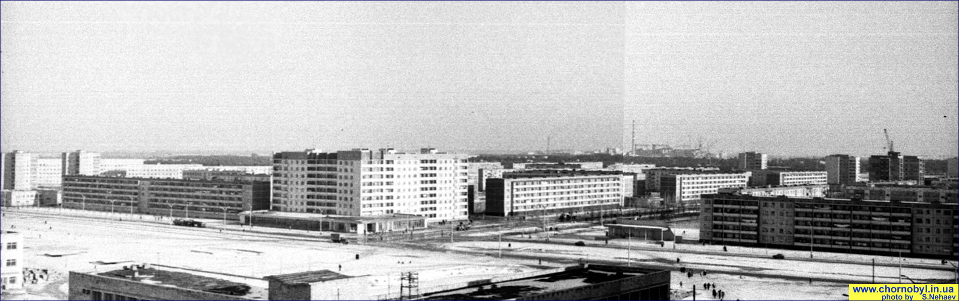
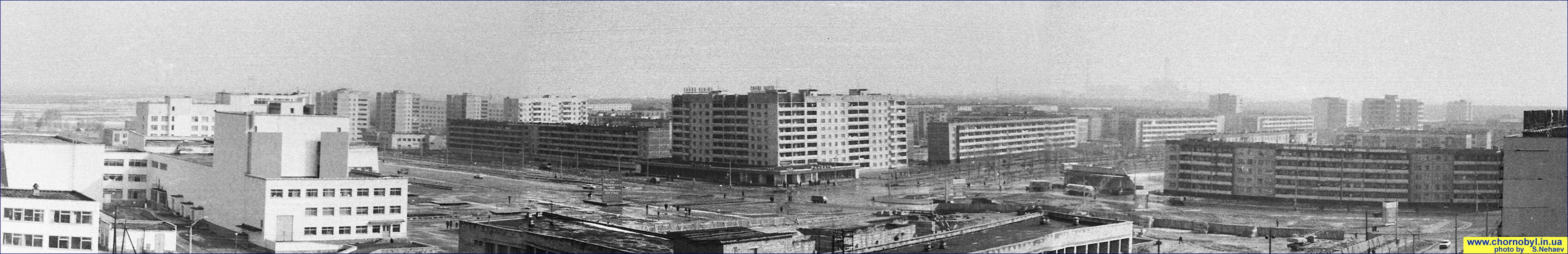
Below are rare photographs of the Pripyat city, taken by Sergey Nechaev during the period 1980-1983. The uniqueness of the photographs is due to his shooting from the same location over several years, creating Pripyat “landscapes” that allowed us to re-create the city panorama of the time. The photographs were submitted direct by the author and published with his consent.
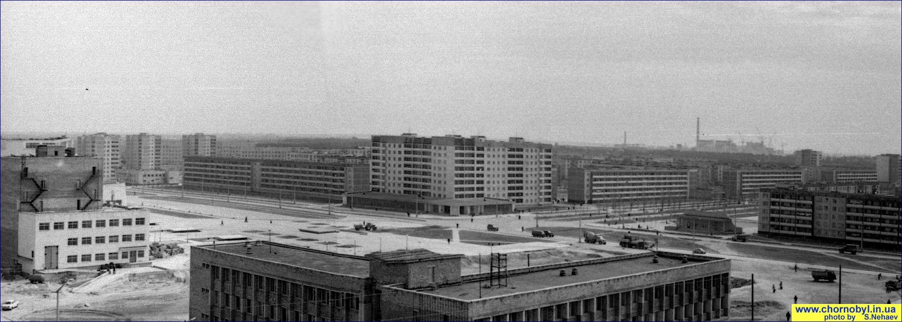
Panorama of the central area of Pripyat with a view of the Chernobyl Nuclear Power Plant under construction. Author S. Nechaev. Spring 1980.
 Panorama of the central area of Pripyat with a view of the Chernobyl Nuclear Power Plant under construction. Winter 1980-1981.
Panorama of the central area of Pripyat with a view of the Chernobyl Nuclear Power Plant under construction. Spring 1983.
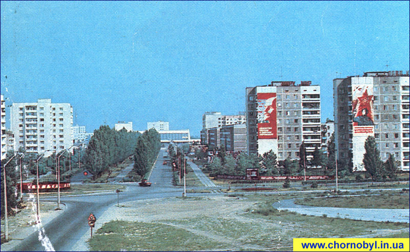
The beauty of the city built for nuclear workers can be seen in photographs that show the greatness of the construction and progressive thought of Soviet Union architects. These photographs are fragments from an information booklet about the city, which was published in 1985.
 |
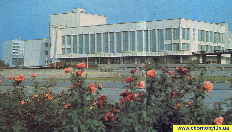 |
| The main entrance to the city | Palace of Culture “Energetik” |
 |
 |
|
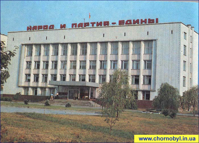
City Administration
|
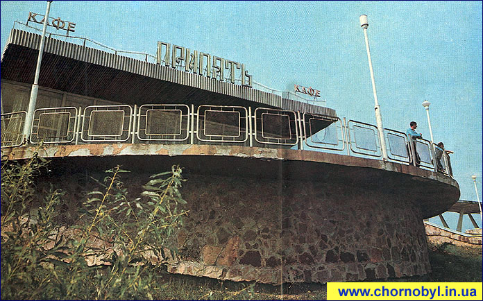
Cafe “Pripyat” at the River Station.
|
The creative approach of city architects and builders allowed for the retention of every tree and bush, and to harmoniously incorporate then into the city landscape. It is not surprising that in Pripyat were many beautiful places for recreation. People from approximately thirteen nationalities lived in Pripyat. Due to this, the first city streets were named Enthusiasts and Friendship of the Peoples.
In the city were built a cultural center, bookstore, cinema, hotel, four libraries, an art school with a concert hall, a complex of medical institutions, and secondary and vocational schools.
 |
 |
|
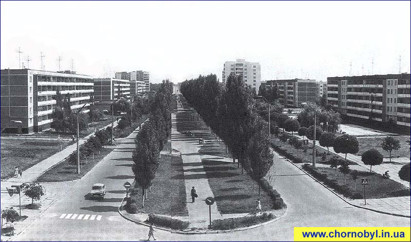
The city center – Lenin Boulevard.
|
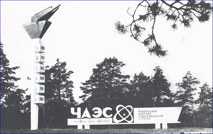
Architectural sign “Flame” (located near the city)
|
Urban infrastructure of the Pripyat town
Builders paid much attention to the creation of a variety of pre-school and sports facilities, since the average age of the city’s young residents was 26 years old. I find it hard to believe, but every year, more than one thousand babies were born in Pripyat. Only in this city could you see a parade of children’s strollers, when in the evening, mothers and fathers walked the streets with their babies.
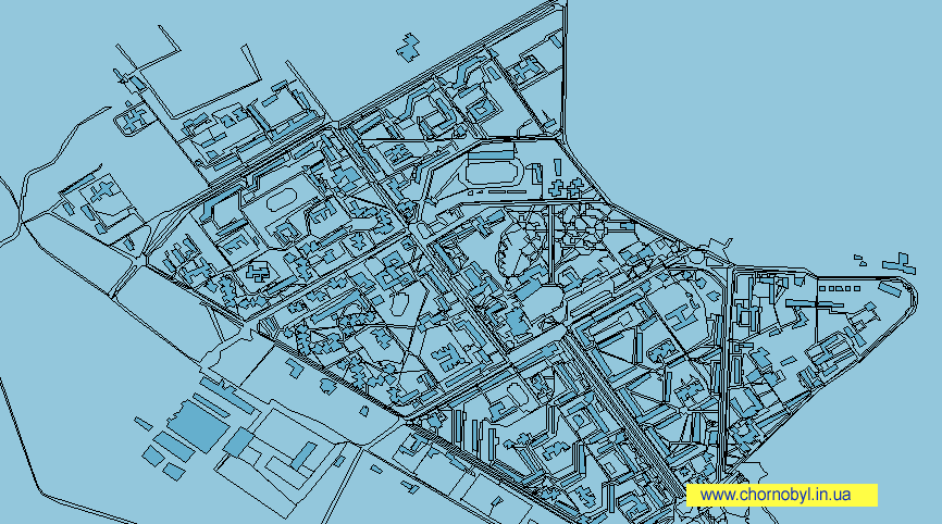
According to the master plans for the development of Pripyat, the city was expected to have a population of 80,000 people. This Polessian atomic-town was to be one of the most beautiful cities in Ukraine. A representation of the city’s layout and infrastructure can be seen in the diagram below.
- Ipatiy annals (published 1908). Kiev annalistic code. In summer 6699 [1191] – in summer 6703[1195].
- Nuclear Energy. Questions and answers. Issue 4. The drafters of the V.A. Krasyuk and Kachalov Metro. IzdAT 1993. p. 48.